Transport gratuit la punctele de livrare Pick Up peste 299 lei
Packeta 15 lei Easybox 20 lei Cargus 25 lei FAN 25 lei

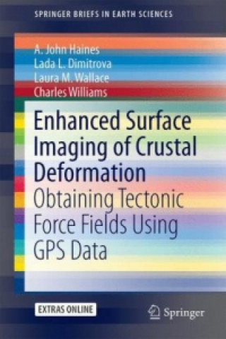
Enhanced Surface Imaging of Crustal Deformation

Limba englezăengleză
Carte Carte broșată
Carte Enhanced Surface Imaging of Crustal Deformation A. John Haines
Codul Libristo: 09372082
Editura Springer International Publishing AG, august 2015
This book takes an in depth look at a novel methodology for analyzing Global Positioning System (GPS... Descrierea completă
? points 144 b
284 lei
În depozitul extern Expediem în 5-7 zile

30 de zile pentru retur bunuri


Ar putea de asemenea, să te intereseze


Ich bin dann mal weg Hape Kerkeling / Carte broșată
common.buy 52 lei
Hunting with the Bow and Arrow Saxton Pope / Carte broșată
common.buy 89 lei
Embrace Your Inner Self Sangita Patel / Carte broșată
common.buy 46 lei
Essential Oils for Beginners Althea Press / Carte broșată
common.buy 59 lei
Messenger Mayra Montero / Carte broșată
common.buy 92 lei
Praticas pedagogicas de lingua portuguesa no ensino medio Ribeiro Pastore Roberta / Carte broșată
common.buy 332 lei
Fever Hospital W.K. Anderson / Copertă tare
common.buy 220 lei
Rise Tectonic Machines! Marcus Shaffer / Carte broșată
common.buy 142 lei
Dying Embers and Shooting Stars Maggi Sale / Carte broșată
common.buy 148 lei
Devil's Tryin' To Kill Me Browdy / Copertă tare
common.buy 142 lei
Canoeing and Kayaking College Campuses in Michigan Doc Fletcher / Carte broșată
common.buy 104 lei

This book takes an in depth look at a novel methodology for analyzing Global Positioning System (GPS) data to obtain the highest possible resolution surface imaging of tectonic deformation sources without prescribing the nature of either the sources or the subsurface medium. GPS methods are widely used to track the surface expression of crustal deformation at tectonic plate boundaries, and are typically expressed in terms of velocity fields or strain rate fields. Vertical derivatives of horizontal stress (VDoHS) rates at the Earth's surface can also be derived from GPS velocities, and VDoHS rates provide much higher resolution information about subsurface deformation sources than velocities or strain rates. In particular, VDoHS rates allow for high precision estimates of fault dips, slip rates and locking depths, as well as objective characterization of previously unknown (or hidden) tectonic deformation zones.§

Informații despre carte

Titlu complet Enhanced Surface Imaging of Crustal Deformation
Limba engleză
Legare Carte - Carte broșată
Data publicării 2015
Număr pagini 99
EAN 9783319215778
ISBN 3319215779
Codul Libristo 09372082
Greutatea 2029
Dimensiuni 155 x 235 x 8
Dăruiește această carte chiar astăzi
Este foarte ușor
1 Adaugă cartea în coș și selectează Livrează ca un cadou 2 Îți vom trimite un voucher în schimb 3 Cartea va ajunge direct la adresa destinatarului

Logare

Conectare la contul de utilizator Încă nu ai un cont Libristo? Crează acum!

 
obligatoriu
obligatoriu

Nu ai un cont? Beneficii cu contul Libristo!

Datorită contului Libristo, vei avea totul sub control.

Creare cont Libristo